Заглавная страница Избранные статьи Случайная статья Познавательные статьи Новые добавления Обратная связь КАТЕГОРИИ: ТОП 10 на сайте Приготовление дезинфицирующих растворов различной концентрацииТехника нижней прямой подачи мяча. Франко-прусская война (причины и последствия) Организация работы процедурного кабинета Смысловое и механическое запоминание, их место и роль в усвоении знаний Коммуникативные барьеры и пути их преодоления Обработка изделий медицинского назначения многократного применения Образцы текста публицистического стиля Четыре типа изменения баланса Задачи с ответами для Всероссийской олимпиады по праву 
Мы поможем в написании ваших работ! ЗНАЕТЕ ЛИ ВЫ?
Влияние общества на человека
Приготовление дезинфицирующих растворов различной концентрации Практические работы по географии для 6 класса Организация работы процедурного кабинета Изменения в неживой природе осенью Уборка процедурного кабинета Сольфеджио. Все правила по сольфеджио Балочные системы. Определение реакций опор и моментов защемления |
Таврійського державного агротехнологічного університету»Стр 1 из 17Следующая ⇒
ВСП «Ногайський коледж Таврійського державного агротехнологічного університету»
МЕТОДИЧНІ РЕКОМЕНДАЦІЇ З дисципліни «Англійської мови за професійним спрямуванням» для студентів спеціальності 5.08010102 «Землевпорядкування» ІІ семестр (ЗМ 3-4) ІІІ семестр (ЗМ 5-6) Викладач: Кошель І. М. Р. Кошель І. М. Методичні рекомендації з дисципліни “Англійська мова професійного спілкування” для студентів денної форми навчання спеціальності «Землевпорядкування» 3 курс ІІ - ІІІ семестр (ЗМ 3-6) Приморськ, 2015. – 58 с.
ПЕРЕДМОВА Цей навчальний посібник складено для роботи над розмовними темами, граматичним матеріалом та текстами для самостійного опрацювання для студентів 3 курсів землевпорядних спеціальностей. Мета: допомогти студентам в опануванні лексичного мінімуму та граматичного матеріалу та підготувати їх до опрацювання літератури з загально – мовного циклу та зі спеціальності англійськоюмовою. Даний посібник має за мету допомогти студентам в роботі над удосконаленням своїх знань та умінь з іноземної мови. Щоб зрозуміти зміст фахового тексту, необхідно повторити особливості граматики англійської мови, навчитись аналізувати текст, розрізняти лексичне значення слова. ЗМІСТ
TWO BRANCHES OF AGRICULTURE
There are two main branches of agricultural production - crop production and animal husbandry. Crop production is the practice of growing and harvesting crops. The most important crops grown by man are grain crops, vegetables and grasses. In order to obtain high yields crops are grown under favourable soil and climatic conditions? Animal husbandry is a branch of agriculture including tfee breeding of farm. animals and their use. Dairy and beef cattle, hogs, sheep, and poultry are widely bred throughout the world. Farm animals are highly important sources of food for man. They are kept for the production of such nutritious products as meat, milk and eggs. Many crops grown by man are used in feeding livestock. At the same time manure produced by farm animals is an important source for the maintenance of soil fertility. Most of the nutrients taken by plants from the soil are thus returned. Applying manure, farmers improve the physical condition of the soil. Thus, crop production and animal husbandry are closely connected with each other. 3. Answer the questions: 1. Why is agriculture very important? 2. What are the two branches of agriculture?
3. What does the Latin word agre mean? 4. Is life possible without plants? 5. Where are farm crops used? 6. How do people increase crop yields? 4. Випишіть речения, в якому вжите дієслово "to be " в модальному значенні і перекладіть його на українську мову: а) I were to go to a lawyer. b) I was going to say I could not come on board. c) As soon as we were aboard I turned back. d) I felt I was lost. 5. Випишіть із тексту 4 речения з прийменниками: of, in, to, on. 6. Підкресліть в словах префікс, суфікс, перекладіть слова: failure, differens, interatomic, semifinal, neighbourhood, careful, talkative, lengthen, submarine, pre-war, illogical, usually, disappear, misunderstand. 7. Складіть речення застосовуючи слова та словосполучення з дієсловами в Present Continuous Tense: to cook in the kitchen, to help, to wash dishes, to sit, to have supper. 8. Утворіть множину слідуюсих іменників: a piano, a set. a price, a knife, a lorry. 9. Напишіть числівники словами: 1,9,37, 53,103,66,15. 10. Утворіть ступені порівняння прикметників: small, nice, early, hot, interesting, many.
11. Read the text and answer the questions. The Pig The pig is a very useful animal. People like its flesh which is called pork. When people salt it, it is called bacon and ham. Besides pork people get from the pig leather and stiff hairs of which they make brushes. 12. Questions: 1.Is the pig a useful animal? 2.How is the pig's flesh called? 3.How is the salt pork called? 4.What else do people get from the pig? Word List 1. fertile soil родючий грунт 2. grain crops зернові культури 3. industrial crops технічні культури 4. fruit raising плодівництво 5. vegetable raising овочівництво 6. cereals хлібні злаки 7. wheat пшениця 8. rye жито 9. oats овес 10. barley ячмінь 11. maize кукурудза 12. legumes зернобобові 13. buckwheat гречка 14. millet просо 15. rice рИС 16. sugar beet цукровий буряк 17. sunflower соняшник 18. flex льон 19. cabbage капуста 20. tomato помідор 21. cucumber огірок 22. onion цибуля 23. carrot морква 24. garlic часник 25. potato картопля 26. cattle breeding розведення великої рогатої худоби, скотарство 27. pig raising свинарство 28. sheep farming вівчарство 29. poultry свійська птиця 30. chicken курка, курча 31. duck качка 32. goose гусак, гуска 33. turkey індик 34. melon диня 35. livestock худоба 36. fishfarming рибництво 37. beekeeping бджільництво 38. fur animals хутрові звірі 39. hectare гектар 40. arable lands орні землі, рілля 41. agricultural lands сільгоспугіддя 42. watered lands зрошувані землі 43. dried lands осушені землі 1. Practise the pronunciation of the following words: a) stress the first syllable: fertile, soil, temperately, climate, farming, breadbasket, animal, practice, crop, growing, harvesting, grain, meadow, fruit, vegetable, raising, cereal, flax, rye, oat. barley, sugar beet, sunflower, cabbage, cucumber, carrot, onion, garlic, melon, wheat, maize, legume, husbandry, widespread, dairy, province, chicken, duck, goose, turkey, cattle, poultry, mechanize, wages, profit, agriculture; b) stress the second syllable: productive, collective, intensive, potato, tomato, control, increase, apply, include, industrial, technology. 2. Read and translate the text:: Agriculture of Ukraine Ukraine has very favourable conditions for the development of agricultural production: fertile soils, temperately warm climate, a well-developed industry processing agricultural raw materials. Ukraine is one of the world's most productive farming regions and is known as the breadbasket of Europe. There are two main branches of agricultural production in Ukraine: crop production and animal husbandry. Crop production is the practice of growing and harvesting crops. It includes: grain and industrial crops, meadow culture, fruit and vegetable raising. Almost half of the cropping area is occupied by cereals such as winter wheat, maize and legumes, rye, oats and barley. Among the industrial crops such as sugar beet, sunflower, flax the leading position is occupied by sugar beet. Close to 40 types of vegetable crops are grown in Ukraine: potatoes, cabbage, tomatoes, cucumbers, red beets, carrots, onions, garlic, etc. Melon-growing is practised mainly in the south. Animal husbandry is the practice of breeding of farm animals and their use. The most widespread branches of animal husbandry are: dairy and beef cattle breeding, pig raising, sheep farming and bee-keeping. The poultry industry is spread through all the provinces. Birds farmed include chicken, duck, goose, turkey. There are large mechanized poultry farms to produce eggs and meat. Most farms in Ukraine are owned and controlled by the government. They include state farms and collective farms. State farms are managed entirely by the government, which pays wages to farmworkers. Collective farms are owned and managed in part by the workers, who receive wages as well as a share in the farm's profits. State farms are larger and have more mechanical farm equipment than collective farms. In order to increase crop yields and animal products collective and slate farms apply widely intensive technologies.
1. Запишіть наступні слова та словосполучення у словник та вивчіть: 3. Topical vocabulary: 1. crop production — рослинництво 2. animal husbandry — тваринництво 3. grain and industrial crops — зернові та технічні культури 4. cereals — xni6ni злаки 5. dairy and beef cattle breeding — розведення молочної та м’ясної худоби 6. pig raising — свинарство 7. sheep farming — вівчарство 8. bee-keeping — бджільництво 9. poultry industry — птахівництво 10. state farms — державні підприємства 11. collective farms — колективні підприємства VOCABULARY EXERCISES I. Define the parts of speech of the following words: favourable, production, agricultural, temperately, productive, vegetable, warm, mainly, cultivate, equipment, widely, collective, entirely, receive, almost. II. Give the Ukrainian equivalents for the following words and word-combinations. Use them in the sentences of your own: favourable conditions; agricultural production; fertile soils; agricultural raw material; crop production; animal husbandry; grain crops; industrial crops; temperately warm climate; dairy and beef cattle breeding; poultry industry; state and collective farms. III. Fill in the blanks with prepositions or adverbs if necessary: 1. Ukraine has very favourable conditions... the development... agricultural production. 2. Almost half... the cropping area is occupied... cereals. 3. Among the industrial crops the leading position is occupied... sugar beet. 4. Melon-growing is practised mainly... the south. 5. The poultry industry is spread... all the provinces. 6. Most... farms...Ukraine are owned and controlled... the government. IV. Translate the sentences paying attention to the italicized words: 1. Most of the farms in our region are animal breeding farms. 2. There are some plants that are used only in medicine. 3. Intensification of agricultural production is the most important problem now. 4. In our country there are some plants producing chemical fertilizers. 5. Our farm plants some of the crops in autumn. 6. Many people go to the country in summer. 7. That bird has a large crop. 8. Grain crops are widely grown by farmers. 9. Animal husbandry is more important on this farm than crop production. V. Memorize the meanings of the word «agriculture» and its derivatives. Translate the sentences paying attention to the italicized words: agriculture —сільське господарство; землеробство; агрономія; agricultural —сільськогосподарський; землеробський; agriculturist — агроном; сільський трудівник; землевласник. 1. This farm has different agricultural machines. 2. Cooperation with other countries is favourable to agriculture of Ukraine. 3. The agriculturist of today wants to have better and higher-yielding crops which can produce more food of good quality. VI. Complete the following sentences: 1. Ukraine has very favourable conditions... 2. There are two main branches of agricultural production in Ukraine... 3. Crop production is.. 4. It includes... 5. Almost half of the cropping area is occupied by cereals such as... 6. Close to 40 types of vegetable crops are grown in Ukraine:... 7. Animal husbandry is.... 8. Birds farmed include.... 9. In order to increase crop yields and animal products collective and state farms apply.... VII. Answer the following questions: 1. Does Ukraine have favourable conditions for the development of agri-cultural production? 2. What are the main branches of agricultural production in Ukraine? 3. What is crop production? 4. What does crop production include? 5. What cereals occupy half of the cropping area? 6. What vegetable crops are grown in Ukraine? 7. What is animal husbandry?
8. What are the most wide-spread branches of animal husbandry? 9. Where is the poultry industry spread? 10. What birds are farmed in Ukraine? 11. What forms of farm enterprises do you know? 12. What is the difference between state and collective farms? VIII. Translate into English: 1. Україна має дуже сприятливі умови для розвитку сільськогосподарського виробництва. 2. Є дві головні галузі сільськогосподарського виробництва вУкраїні: рослинництво та тваринництво. 3. Рослинництво —це вирощування та збирання сільськогосподарських культур. 4. Рослинництво включає вирощування зернових та технічних культур, луківництво плодівництво та овочівство. 5. Майже половину посівної площі країни займають хлібні злаки. 6. Найважливішою технічною культурою в Україні є цукровий буряк. 7. Тваринництво — це розведення сільськогосподарських тварин та їх використання. 8. Розведення молочної та м’ясної худоби, свинарство, вівчарство, бджільництво та птахівництво — найпоширеніші галузі тваринництва в Україні. 9. Більшість сільськогосподарських підприємств в Україні контролюється урядом.
Agrarian Sector of Ukraine Ukraine has very favourable conditions for the development of agricultural production: fertile soils, temperately warm climate, a well-developed industry processing agricultural raw materials. All the principal areas of plant cultivation arc: grain and industrial crops, meadow crops, fruit and vegetable raising. Almost half of the cropping area is occupied by cereals such as: winter wheat, maize and legumes, rye, oats, barley. The principal grain crop, winter wheat, is sown mainly in the Steppe and Forest-Steppe zones. Maize is grown mostly in Transcarpathia and Steppe zones. Buckwheat, millet, rice play an important role. Among the industrial crops such as sugar beet, sunflower, flax, the leading position is occupied by sugar beet. Close to 40 types of vegetable crops are grown in Ukraine: cabbage, tomatoes, cucumbers, red beet, carrot, onion, garlic, etc. Melon growing is practised mainly in the south. Potatoes occupy 6% of total area under cultivation. Animal husbandry is the second largest component of agriculture. Like plant cultivation, livestock production is divided into branches. The most widespread branch is cattle breeding, pig raising is another important area. Sheep farming is also practised. The poultry industry is spread in all the provinces. Birds fanned include chickens, ducks, geese, turkeys. There are large mechanized poultry factories to produce eggs and meat. Fish farming is growing in importance, with carp being the most common fish. Trout, which is to be found in the mountain rivers, is of commercial interest. Bee keeping is spread through all zones. It is exte.. jvcly practised on private plots. Fur animals being farmed include the silver and blue fox, mink and nutria. Agricultural production in Ukraine is organized around the state and collec thousand hectares. Вправа 1 Дайте всі значення слів та словосполучень: a) to farm - farm - farmer - farming; b) to grow - growing — grown; c) to milk - milk - milking - milker - milky; d) dairy - dairying. Вправа 2 Згрупуйте дані слова н синоніми: a) agriculture, grassland, husbandry, soil, dairy, grazing, milky, growing, b) to breed, to give, to harvest, to produce, to cut, to grow well, to rear, to' yield, to do well; c) grain, feed, cereal, seed, farm, fodder, holding. Вправа З Виберіть узагальнюючі слова: a) corn, cereals, barley, oats, rye; b) root crops, sugar beet, carrot, turnip; c) cucumbers, tomatoes, vegetables, red beet, cabbage; d) sheep, pigs, livestock, cows; e) wheat, barley, crops, potato. Вправа 4 Підберіть терміни, подані ліворуч, до їх визначень праворуч: А: 1. poultry a) a farm animal reared for wool and meat; 2. breed b) the meat of an animal of the cow family; 3.calf c) domesticated birds used for food or egg production; 4. feed d) animals raised on a farm; 5. sheep e) the young of cattle; 6. livestock f) the classification of a type of animal. B: 1. hybrid a) a type of crop which is planted in the fall (autumn);
2. crop rotation b) temporary grassland; 3. strain c) organic material used as fertilizer; 4. lea d) growing various crops at different times on the same land in a planned series; 5. winter crop e) a plant that results from the crossing of different varieties: 6. dung f) a variety, especially obtained by cross fertilizing (перехресне запліднення) Вправа 5 Дайте відповіді на запитання 1. What are the conditions for the development of Ukrainian agriculture? 2. What are its principal areas of plant cultivation? 3. Where is winter wheat sown? 4. Which crop occupies the leading position among the industrial crops? 5. What vegetables do they grow in Ukraine? 6. What area under cultivation is occupied by potatoes? 7. How is livestock production divided? ' 8. What is the most widespread branch of animal breeding? 9. What birds are farmed in Ukraine? 10. How is agricultural production organized in Ukraine? 11. What is per capita land supply in our country? 12. How many hectares of lands are watered and dried in Ukraine?
Farms in Britain Geographically Great Britain consists of Highland Britain and Lowland Britain. Highland Britain is in the north and in the west. The agricultural area of England is toward the English Channel1 and the Continent of Europe. The soil in many parts of Highland Britain is thin and poor. Lowland Britain is a rich area with fertile soil. Rivers in Britain are narrow, but the Thames. Most of the farms are less than 50 acres2 each. The types of farms are different in different soil and climatic areas. In the eastern part of Britain most farms are arable the farmers grow different crops there. In the western part of the country most farms are dairy. Small farms in Britain are usually mixed farms on which farmers both grow crops and keep farm animals. As we have mentioned most of Britain is the farming land divided into many fields. Today the main tendency in agricultural development of this country is that small traditional farms are gradually disappearing because they cannot compete with modern big industrial farms. Britain has a mild climate. The western winds from the Atlantic carry the warmth and moisture of lower latitudes3, into Britain. The weather changes with the wind. Winds from different parts of the world ranging from polar to tropical regions often visit Britain. Britain has a mild climate. The temperature seldom exceeds 32°C4 or falls below zero. The driest period is from March to June and the wettest months are from October to January. Thus farmers work fields all the year round. The main agricultural products of Britain are wheat, barley, oats, potatoes, milk and different kinds of meat. A comparatively high level of agriculture enables Britain to provide about half of the food from its soil. Britain usually imports meat, butter, wheat, tea, fruit, tobacco etc. There are a few millions of acres of woodland in Great Britain. The estimated private forests make up about a half of the forest area. The size of private woodlands ranges from a few acres to many thousands.
8. Translate words: to reconstruct, to reappear, to recollect, to reform, to reimport, to recover, to re-do, to re-house, to remake, to rename, to reopen, to reorganize, to replace, to replant Ø Form nouns from adjectives with the help of the suffix –ness and translate the words: Ø goad, black, busy, fine, green, large, light, near, open, red, sad Ø Translate words into Ukrainian: co-operation, co-operative, co-operator, co-ordination, coauthor Ø Translate words into Ukrainian without using the dictionary: farm, geographically, agricultural, acre, type, climatic, tendency, traditional, modern, industrial, polar, tropical, region, visit v, temperature, period, product, import v, fruit, tobacco, policeman, information Ø Read and translate words, name the Part of Speech: farms, different, climatic, farmer, development, traditional, industrial, disappearing, warmth, moisture, tropical, driest, wettest, comparative, usually 9. Retell the text” Farms in Britain “
LAND RESOURCES Ukraine is one of the largest Europe countries, the area is 60,37 million ha and it's 5.7 % of Europe territory or about 0.5% of the globe. Most territory of Ukraine is situated in the western part of East European plain, in the South it is washed by the Sea of Azov and the Black Sea. Freshwater resources are concentrated in 73 thousand of big and small rivers which flow through its territory and about 20 thousand of lakes. Dnipro is the third longest river in Europe. The Carpathian Mountains are on the West of Ukraine and the Crimea is in the South. The relief of 60% of the agricultural land is flat and 35 % has slopes ranging between 1 and 3 degrees. Agricultural lands of Ukraine comprise 41.76 million ha or 70 % of the territory of Ukraine, including ploughed lands 32.4 million ha or 54 %, pastures - 9 %, hay - 4 % and long term planting - 2 %. Climate conditions and good soils (third part of World reserve of black earth or 54 % of own lands) are very favorable for agriculture production. That is why there is the highest level of ploughed soils in Europe - near 78 %. The territory of Ukraine is divided into three main natural and climate zones - Marshywoodlands (Polissia), Forest-steppe (Lisostep) and Steppe (Step). The Marshy woodlands zone occupies the northern part of Ukraine, the total is 11.35 million ha (19 % of the entire territory of Ukraine) and is characterized by lowlands relief, continental climate with warm and humid summers and mild winters, turfy-podzolic soils (75 %), woodiness (30 %), haymaking - 1.2 million ha and the pasture (0.7 million ha). Ploughed lands occupy 33 % of the entire zone territory (4million ha). This is the main zone for grain production (rye, oats, and buckwheat), technical crops, flax, hop, sugar beet and potato as well as the processing of flax, meat and dairy produce. The Forest-steppe zone is located in central part of Ukraine and its area is 20.2 million ha. It is mainly flat with temperate continental climate, woodiness is insignificant (about 12 %), topsoil is quite diverse with an intermittence of podzolic soils and typical black soils. Agricultural lands occupy 70 % of the territory including 66 % of ploughed lands. The structure of sown areas: winter wheat - more than 30 %, corn - 10 %, about 8 % - barley and pulse crops, more than 10 % is devoted to sugar beet and sunflower. There is also popular meat dairy and pig production here. The Steppe zone includes is the entire southern and eastern parts of Ukraine with mainly flat relief (24 million ha) and is characterized by temperate and continental climate with hot summers and cold winters. 90 % of Forest-steppe occupies black earth. This is the zone of maximum plough for Ukraine and about 48 % of Ukraine's ploughed land rest on this steppe.
EXERCISES I. Give English equivalents in Geography and Land surface for the following:
ІІ. Choose the correct word: 1. Agricultural land of Ukraine………41,76 million ha or 70% of territory of Ukraine a) involve b) include c) comprise d) consist of 2.The territory of Ukraine is divided into three...... natural and a) chief b) principal c) major d) main 3.90% of Forest - steppe occupies black……….. a) soil b) earth c) ground d) land 4.There is the.... level of ploughed soils in Europe - near 78%. a) tallest b) highest c) greatest d) biggest 5.Freshwater resources are concentrated in 73 thousand rivers a) across b) over c) via d) through 6.Ploughed lands occupy 33% of the.... zone territory, a) entire b) whole c) all d) intact 7.73 thousand of big and small rivers…..through the territory of Ukraine. a) stream b) flow c) run d) flush 8.Most territory of Ukraine…..in the western part of East European plain a) is located b) is concentrated c) is situated d) is based 9.Topsoil is quite....with an intermittence of podzolic soils and a) varied b) diverse c) different d) uncultivated
III. Ask and answer: a. if Dnipro is the third longest river in Europe; b. if Ukraine has favourable climate conditions and good soils for agriculture production; c. if the Marshy woodlands zone occupies the northern part of Ukraine; d. if there are 73.000 big and small rivers and about 20.000 lakes in Ukraine; 2. e)if he knows the crops which are grown in the Forest – steppe zone; a. if he agrees that maximum plough for Ukraine is in the steppe zone; b. if he believes that the Marshy woodlands zone is characterized by lowlands relief; c. if he can explain in which of the three natural and climate zones popular meat, dairy and pig production is concentrated; d. if he knows which of the three zones is the main one for grain production. IV.Translate into English: 1. Приватна власність на землю — це головна «опора» для створення ринкової економіки. 2. Для того, щоб купити землю, треба маги гроші. 3. Бізнесмени купують або продають землю чи інші природні ресурси, якщо сподіваються на прибуток від цієї угоди. 4. Із самого ранку вони обговорюють питання щодо розвитку земельних відносин в Україні. 5. Коли вона зателефонувала, ми розмовляли про те, чому ніхто в нашій країні не хоче брати землю. 6. Ми спостерігали, як студенти слухали лекцію про ринок землі в Україні. 7. Як звуть доповідача, що розповідає зараз про розвиток земельної реформи в Україні? 8. Студенти ще не прослухали лекції про сучасний стан земельної реформи в нашій країні. Прочтите, переведите текст Structure of land resources One of the major problems the country is currently facing is the state of the land resources. As is shown by data presented by the State Committee for Statistics of Ukraine, the land resources of Ukraine amounted to 60.4 million hectares at the beginning of 1999. Agricultural land occupies 72% of the country’s territory, out of which 69% is arable land, including 54.4% of tillage, 0.4% of virgin land, 1.6% of perennial plantations, 3.8% of hayfields and 9.1% of pasturelands. Forests and other plantations take up 17.2% of all the territory, swamps 1.6%, land without any plantation 1.8%, and territory under water reservoirs 4.0%. In 1998 certain changes took place in the structure of the land resources. Thus, in comparison with 1997, the area of the arable land decreased by 27,800 hectares, with the area of tillage being reduced by 223,400 hectares, the area of perennial plants by 37,500 hectares, and that of hayfields by 11,500 hectares. As compared to 1997, pasturelands were expanded by 28,100 hectares in 1998, areas of forests and other plantations by 17,400 hectares, built-up territories by 105,100 hectares, and open swamplands by 3,700 hectares. The area of land without any plantation contracted by 10,400 hectares. In accordance with the State Land Cadastre, the area of the most valuable land within the structure of the country’s arable land accounts for about 12 million hectares. The total area of land allocated for non-agricultural utilization contracted by 10,900 hectares in 1998 as compared to 1997, the area of arable land was reduced by 100 hectares, and the tillage area by 100 hectares. Certain territories were set aside to meet state and public needs, namely, to construct or develop industrial enterprises and transportation infrastructure, and towns and built-up areas. A sizable area – 159,000 hectares is occupied by radioactively contaminated arable lands, which are not used for agricultural production, plus 161,400 hectares of deteriorated land. The changes in the structure and area of land resources are taking place during a process of allocation of land for forming protective forest plantations and field-protecting forest strips, construction of anti-erosion hydrotechnical structures, silt-catching basins and river-bank reinforcements to protect agricultural lands, and the recultivation of deteriorated lands. The decrease of the tillage area also took place during a process of turning heavily eroded, swamped and flooded areas into hayfields and pasturelands. In 1998 the process of the land privatization was continued. As of 1 January 1999 the state possessed 48.8% of the total land, collective agricultural enterprises owned 46.0%, and private owners possessed 5.2% of all land. The area of land utilized for environmental protection has increased considerably and now accounts for 2,314,500 hectares. Land used for sanitary facilities amounts to 29,300 hectares; land for recreation facilities totals 94,400 hectares; and areas of historical parks and reserves 41,700 hectares. TYPES OF SOIL SOIL AND ITS MANAGEMENT Good farming means proper use of many factors such as natural conditions, land, crops, livestock, machinery, fertilizers and some others. All these factors have to be put together to make the farming system work successfully. One of the most important points to be taken into consideration in farming is the soil which is known to be a natural resource that supports plant life. It is a mixture of particles of rock, organic materials, living forms, air and water. During his entire existence upon the earth man has depended on the soil, either directly or indirectly. Grain, fruits and vegetables are food products obtained by man directly from the soil. Domestic animals consume grain and forage produced by the soil and in turn supply people with meat, milk, eggs and other products used for human food. These are the products obtained from the soil indirectly. Some good clay and loamy soils are naturally highly fertile, some light sandy soils are naturally poor. Various factors that make up soil fertility are moisture conditions, plant food and soil structure. All these components may be regulated by proper management of the soil. Soil management is the science of tillage operations, cropping practices using fertilizers, lime and other treatments conducted on, or applied to. Plant growth and yields can be increasing by applying certain recommended soil management practices, liming, fertilization and irrigation producing, as a rule, immediate yield increases. Good soil management results in better yields and lower cost per unit of production. Fertile soils produce plants that are less affected by diseases and less likely to be attacked by insects. In this case small losses of crops result. The feed that livestock eat is reflected in their health. The healthiest animals are found on farms that have productive soils producing high-quality feed for livestock. Certain nutrient elements are essential in the animal’s diet for proper growth, reproduction and production. The lack of one or more elements can cause stunted animals, less milk, smaller litters and certain animal diseases. So, a good chemical composition of soils provides better conditions for seed germination and plant growth.
3. Дайте відповіді на питання до тексту: 1. What means good farming? 2. What are the main components of a fertile soil? 3. What particles does the soil consist of? 4. What soils are naturally highly fertile? 5. What does the soil management deal with? 6. What influences upon the livestock? 4.Перекладіть на українську: 1. I don’t know whether good farming can ensure a proper use of natural resources, land, livestock, machinery and fertilizers. 2. If the crops are yielded from a good loam, the harvest may be rather sufficient. 3. If we sow grain crops on the fertile soils, the harvest will be very good. 4. Our main task is to determine whether lime should be applied to the soil. 5. We don’t know whether sandy soils are good for flax. 5. Згрупуйте слова у відповідності до значення дієслова TO MAKE: 1) робити; 2) примушувати: 1.Sunlight makes the temperature of water raise, which leads to its evaporation. 2. Different methods are used by farmers to make high quality hay. 3. The students were made to pass the examination earlier. 4.The use of greenhouses makes the heat balance of the area change.5.Physical and biological factors act to make a wide variety of environments in the world. 6. Перекладіть на українську: 1. A mixture of organical matter and the soil that is subjected to biological decomposition. 2. The protection of natural resources according to principles that will assure their highest economic efficiency. 3. The practice of crop production in low rainfall areas is impossible without irrigation. 4. All the external conditions that may act upon an organism to influence its development or existence.
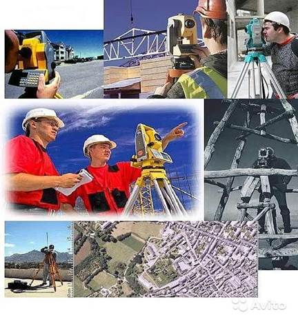
СПОСОБИ ОБРОБКИ ҐРУНТІВ EXERCISES 1. Визначте значеня виділени слів та словосполучень за схожістю з українськими словами: taiga, tundra, Middle Asia, effective cultivation, subtropical climate, cultivation of citrus, climate zones, transpiration of the vegetation cover, Carpathian Mountains, the steppe zone, chernozem, polar deserts/ 2. Випишіть парами слова-пароніми: exception, severe, uneven, rule, approximate, mild, accurate, exclude, include, former, excessive, latter, insufficient, even. 3. Перекладіть слова, звертаючи увагу на словотворчі суфікси: 1) mountain, mountainous, mountaineer; 2) climate, climatic, climatically; 3) probable, probably, probability; 4) frequent, frequency, frequently; 5) approximate, approximately, approximation; 6) accurate, accurately, accuracy. DEVELOPMENT OF SURVEYING 1. Слова та словосполучення: survey зйомка to survey проводити зйомку surveyor землемір boundary межа, кордон B.C (before Crist) до нашої ери divide ділити record документ plot наносити на карту, ділянка stretch тягнути measure виміряти, міра markers at unit distances помітки на рівних відстанях to be due to бути зобов'язаним чому-небудь apply застосовувати include включати calculation вирахування contain вміщувати в собі to take into consideration брати до уваги disregard нехтувати чим-небудь scop сфера plane surveying горизонтальна зйомка geodetic surveying геодезична зйомка 2.Прочитайте та перекладіть текст: DEVELOPMENT OF SURVEYING Surveying is one of the oldest arts practiced by a man. From the earliest times a man has found it necessary to mark his boundaries and divide his land. The oldest historical records in existence today which bear directly on the subject state that surveying had its beginning in Egypt. Heradotus says Sesostris (about 1400 B.C.) divided the land of Egypt into plots for purpose of taxation. The annual floods of the river Nile swept away portions of these plots, and surveyors were appointed to replace the bounds. These early surveyors were called "rope stretchers". Their measurements were made by means of ropes with markers at unit distances. As a consequence of this work there arose the science of geometry. It is to the early Greek thinkers that the development of the science of geometry is due. This development, however, was chiefly along the lines of pure science. The man, who stands out prominently through the age of Grecian supremacy, as applying science of Geometry to surveying was Heron who flourished probably about 120 B.C. He was the author of several important writings of interest to engineers, including one in particular called "The Dioptra" which treated of methods of surveying a field drawing a Plan, and making calculation. It also contained a most interesting description of surveying instruments called the Diopter. It is one of the first surveying instruments of which we have record. The work of Heron was the authority for a great many years among Greek and Egyptian surveyors. GRAMMAR EXERCISES 3. Поставте англійською мовою питання до виділених слів 1 Surveying had its beginning IN EGYPT. 2 SURVEYRING is one of the oldest arts practiced by man. 4. Дієслова подані в дужках, поставити у відповідному часі: a) Present Indefinite 1 We (to use) surveying in every day life. 2 The map (to be) a graphical representation of very large areas of land. b) Past Indefinite 1 From the earliest times the people (to divide) the land into plots. 2This book (to be) of great interest to engineers. c) Future Indefinite 1. The students of the faculty of land organization (to study) geodesy next уеar. 2. In a month we (to carry out) the surveying of this field.
Objects of surveying When large portions of the globe surface have to be surveyed, as for instance the area of a whole country or of an entire continent, the spherical shape of the Earth has to be taken into consideration. Work of that nature forms is the object of geodetic surveying. When the survey covers relatively small areas, measuring not more than 60 km. in any direction, the spherical shape of the globe may be disregarded as it will have no practical influence, when the results of the measurements taken аrе plotted on paper. The determination of the shape and size of relatively small areas of land falls within the scope of plane surveying. 6. Дайте відповіді на питання до тексту Впр.2 у письмовій формі: 1. What should be taken into consideration when large portions of the globe have to be surveyed? 2. What do we understand by large portions of the globe surface? 3. What is the object of geodetic surveying? 4. When may the spherical shape of the globe be disregarded? 5. What is the object of plane surveying? Прочитайте текст Photogrammetry Photogrammetry is a non-contact scanning technology that utilizes photographs to make scientific measurements and create digital modeling in 3D. With photogrammetry, It is possible to determine the distance between two points in a photograph if the scale of the image is given. Photogrammetry uses optics, the study and behavior of light, combined with projective geometry to determine points on an object. The distance between these points are then estimated and a 3D digitized model is created. Photogrammetry is used in different fields, such as topographic maping, architecture, engineering, manufacturing, quality control, police investigation, and geology, as well as by archaeologists to quickly produce plans of large or complex sites and by meteorologists as a way to determine the actual wind speed of a tornado where objective weather data cannot be obtained. Stereophotogrammetry is slightly more complex than photogrammetry and utilizes two photographs taken from different angles to estimate intersecting coordinates. With these estimates known, it is possible to create a 3D measurement of an object with the two photos. For the most accurate results, photogrammetric data is combined with range data from 3D laser scanners or white-light digitizers. This is because photogrammetry is extremely accurate measuring the X and Y axis' of a coordinate plane, while 3D laser scanners and white-light scanners are more accurate in the Z axis range. There are many different trades and professions that utilize photogrammetry and stereogrammetry. In engineering and architecture, the image of a building or metal part can be analyzed and CAD designs can be created easily. The entertainment business can utilize photogrammetry by merging real world objects with CGI. With stereophotogrammetry surface maps can be created with just a few photographs.
Ex.2. Дайте відповіді на питання: 1. What is called ‘photogrammetry’? 2. What is the function of the photogrammetry? 3. What it uses? 4. What is created after estimating of the distance between two point? 5. What is Stereophotogrammetry? 6. What is doing for the most accurate results? 7. Where is the photogrammetry? 8. What the aim of the photogrammetry? Ex. 3. Прокоментуйте ілюстрацію. CARTOGRAPHY Cartography or mapmaking (in Greek chartis - map and graphein — write) is the study and practice of making representations of the Earth on a flat surface. Cartography combines science, aesthetics, and technical ability to create a balanced and readable representation that is capable of communicating information effectively and quickly. One problem in creating maps is the simple reality that the surface of the Earth, a curved surface in three-dimensional space, must be represented in two dimensions as a flat surface. This necessarily entails some degree of distortion, which can be dealt with by utilizing projections that minimize distortion in certain areas. Furthermore, the Earth is not a regular sphere, but its shape is instead known as a geoid, which is a highly irregular but exactly knowable and calculable shape. Maps of all scales have traditionally been drawn and made by hand, but the recent advent and spread of computers has revolutionized cartography. Most commercial-quality maps are now made with soft ware that falls into one of three main types: CAD. CIS, and specialized illustration software. Functioning as tools, maps communicate spatial information by making it visible. Spatial information is acquired from measurement of space and can be stored in a database, from which it can be extracted for a variety of purposes. Current trends in this field are moving away from analog methods of mapmaking and toward the creation of increasingly dynamic, interactive maps that can be manipulated digitally. Cartographic representation involves the use of symbols and lines to illustrate geographic phenomena. This can aid in visualizing space in an abstract and portable format. The cartographic process rests on the premise that the world is measurable and that we can make reliable representations or models of that reality. 3.Дайте відповіді на питання: 1. What is the subject of the text? 2. How does the author define "cartography"? 3. What does the problem in creating maps deal with? 4. Do you agree with the concept that the Earth is not a regular sphere? Express your opinion. 5. It's true that maps of all scales have traditionally been drawn and made by hand? 6. What event has revolutionized cartography? 7. Can you say that software has appeared with advent and spread of computers? 8. How many main types does software fall into? 9. Can you explain what spatial information is? 10.What new trends are observed in cartography nowadays? 11.What conclusion does the author arrive at?
EXERCISES 1. Give English equivalents to the following words and word-combinations in the text: складання карт, у двох вимірах, ступінь викривлення, передавати інформацію, база даних, вимірювання простору, програмне забезпечення, географічні явища, мислене уявлення, в абстрактному та переносному значенні, цифровим способом, зображати. 2. Transform the following adverbs into adjectives omitting suffix -ly and translate these adjectives into Ukrainian: effectively, necessarily, quickly, highly, exactly, increasingly, digitally, traditionally. 3. Begin the following words with such negative prefixes as: un-, in-, ir-, de-, dis-, im- and translate these words: balanced, regular, ability, exactly, visible, effectively, measurable, involve, use, known, information, calculable.
READING PLANS AND MAPS. Various features of the earth's surface are pictured on plans and maps by means. of conventional signs. The purpose of conventional signs is to convey a clear image of the country and help one understand the contents of the plan or map. For reading of plans and maps with the aid of conventional signs the signs are made to resemble the features they represent. The skill of plan or map reading is the skill of interpreting the country, represented from the conventional signs. The names of certain objects such as rivers, seas, settlements, etc. available on plans and maps are helpful in understanding their contents. The exercises in reading plans and maps and using them to solve various problems are an important part of the geodetic training. Plans and maps are drawn with the use of conventional signs adopted for the given scale. Conventional signs are drawn either to scale out of scale. The former are used to represent features in compliance with the scale of the plan or a map. This symbol on the plan or a map gives not only the position of the object but its dimensidils as well. If an object is too small to be represented by the conventional sign to scale, the latter is drawn out of scale. The objects represented by such conventional signs occupy on the plan more space than called for by the scale. Out-of-scale symbols are extensively used on maps. Railroads and highway, for instance, are nearly always represented on maps by conventional signs drawn out of scale, i.e., the axis of a railroad or highway is drawn so as to fully correspond to the position of its horizontal projection in nature, but the width of the road is somewhat exaggerated. Plans are finished with the aid of ink. The yellow-green colour goes for water reservoirs (lakes, rivers, ponds) as well as for swamps, saline ground and water-bogged areas; brown ink goes to indicate the relief and sands; black ink - the rest of features as well as inscriptions. The water space is painted either pale blue in the case of fresh water, or lilac in the case of salty waters. These are importance conventional sings(draw them, please):
GEODESY Geodesy is the science of measuring and monitoring the size and shape of the Earth. Geodesists basically assign to points all over the Earth. If you were to stick points in a model of the Earth and then give each of those pins an address, then you would be doing what a geodesist does. By looking at the height, angles, and distances between these locations, geodesists create a spatial reference system that everyone can use. Building roads and bridges, conducting land surveys, and making maps are some
|
||||||||||||||||||||||||||||||||||||||||||||||||||||||||||||||||||||||||||||||||||||||||||||||||||||||||||||||||||||||||||||||||||||||||||||||||||||||||||||||||||||||||||||||||||||||||||||||
|
|
Последнее изменение этой страницы: 2016-12-27; просмотров: 217; Нарушение авторского права страницы; Мы поможем в написании вашей работы! infopedia.su Все материалы представленные на сайте исключительно с целью ознакомления читателями и не преследуют коммерческих целей или нарушение авторских прав. Обратная связь - 18.224.95.38 (0.399 с.) |