Заглавная страница Избранные статьи Случайная статья Познавательные статьи Новые добавления Обратная связь FAQ Написать работу КАТЕГОРИИ: ТОП 10 на сайте Приготовление дезинфицирующих растворов различной концентрацииТехника нижней прямой подачи мяча. Франко-прусская война (причины и последствия) Организация работы процедурного кабинета Смысловое и механическое запоминание, их место и роль в усвоении знаний Коммуникативные барьеры и пути их преодоления Обработка изделий медицинского назначения многократного применения Образцы текста публицистического стиля Четыре типа изменения баланса Задачи с ответами для Всероссийской олимпиады по праву 
Мы поможем в написании ваших работ! ЗНАЕТЕ ЛИ ВЫ?
Влияние общества на человека
Приготовление дезинфицирующих растворов различной концентрации Практические работы по географии для 6 класса Организация работы процедурного кабинета Изменения в неживой природе осенью Уборка процедурного кабинета Сольфеджио. Все правила по сольфеджио Балочные системы. Определение реакций опор и моментов защемления |
Unit 1. Navigational instrumentsСодержание книги
Поиск на нашем сайте INTRODUCTION ПЕРЕДМОВА
Пропоновані методичні вказівки для проведення практичних занять з англійської мови за професійним спрямуванням “Ship Handling” розраховані на курсантів четвертого курсу судноводійного відділення, які мають певний досвід у вивчені англійської мови за професійним спрямуванням. Методичні вказівки розроблено згідно з навчальною та робочою програмами, відповідно до наказу МОН від 17.06.2010 № 587 “Про розроблення навчальних планів вищих навчальних закладів І-ІІ р. а.” Навчальна програма з дисципліни укладена ЦК “Іноземної мови”, враховуючи зміст дисципліни освітньо-професійної програми, а також специфіку спеціальності. За структурою методичні вказівки складаються з 13 уроків, кожен з яких включає комплекс вправ як для аудиторної, так і для самостійної роботи курсантів. Уроки охоплюють основні теми, необхідні для виконання повсякденних обов’язків під час роботи, а саме: засоби забезпечення судноводіння, міжнародні правила попередження зіткнень на морі, стандарти підготовки, дипломування моряків та несення вахти. Кожен урок містить нові слова, вирази, мовні зразки, тексти та мовні ситуації за темою, а також вправи на закріплення граматичного матеріалу. Кожний урок містить теоретичну, тренінгову та контрольно-тестову частини. Для того щоб зробити більш доступним процес оволодіння лексикою за професійним спрямуванням, слова у методичних вказівках подані з транскрипцією. “Ship Handling” допоможе курсантам підвищити свій рівень знань зі спеціальності згідно з сучасними вимогами.
CHAPTER I AIDS TO NAVIGATION UNIT 1. NAVIGATIONAL INSTRUMENTS I. Vocabulary. Study the following words and word combinations: 1. to ascertain [ˏxsq'teIn] – встановлювати 2. to determine [dI'tE:mIn] – визначати, встановлювати 3. dividers [dI'vaIdqz] – вимірювальний циркуль 4. celestial [sI'lestIql] – небесний, астронавігаційний 5. drafting instrument – інструмент для креслення 6. landmark [lxndmQ:k] – береговий орієнтир 7. wing [wIN] – крило 8. altitude ['xltItju:d] – висота, висота над рівнем моря 9. obsolete ['Pbsqli:t] – застарілий, маловживаний 10. needle [ni:dl] – голка 11. reliable [rI'laIb(q)l] – надійний 12. to contain [kqn'teIn] – вміщувати, містити 13. to align [q'laIn] – орієнтувати, налаштовувати, націлюватися, наводити 14. compass rose ['kAmpqs ˏrqVz] – зображення картушкі компаса на карті, компасна троянда 15. equal ['i:kwql] – рівний 16. to indicate ['IndIkeIt] – вказувати 17. accurate ['xkjqrqt] – точний 18. reading ['ri:dIN] – показання (приладу) 19. to take bearing ['be(q)rIN] – брати пеленг 20. terrestrial [tq'restrIql] – земний, наземний 21. magnetic declination [ˏdeklI'neIS(q)n] – магнітне схилення 22. to warp [wO:p] – викривлення 23. to spin [spIn] – обертатися 24. rotation [rqV'teIS(q)n] – обертання II. Do you remember the following words? Translate them into Ukrainian:
III. Read and translate the following text: Navigational instruments refer to the instruments used by nautical navigators and pilots as tools of their trade. The purpose of navigation is to ascertain the present position and to determine the speed, direction etc. to arrive at the port or point of destination. Charts and drafting instruments · Charts are maps of the areas to be navigated with details specific to the marine environment. · Dividers used for measuring lengths of lines and approximate lengths of non-linear paths on a chart. · Nautical almanac used to determine the position in the sky of a celestial body after a sight has been taken. A nautical almanac is a publication describing the positions of a selection of celestial bodies for the purpose of enabling navigators to use celestial navigation to determine the position of their ship while at sea. · Parallel rules used for transferring a line to a parallel position. Also used to compare the orientation of a line to a magnetic or geographic orientation on a compass rose. Parallel rulers are a drafting instrument used by navigators to draw parallel lines on charts. The tool consists of two straight edges joined by two arms which allow them to move closer or further away while always remaining parallel to each other. History. The parallel ruler was invented in about 1584 by Fabrizio Mordente, but it was not in common use until the 18th century. In the 19th century, a Captain William Andrew Field (1796 – 1871) improved the design by adding a protractor-style scale to the upper edge of one rule, and compass points to the opposing edge, which made reading bearings easier. Compasses The compass is an instrument is used for navigation; it generally has a magnetic needle that points towards the Earth’s magnetic North Pole. This is without doubt the most important of all instruments aboard even the most modern vessel, and it is probably the most reliable. The earliest compasses were most likely invented by the Chinese in around 1050 BC. They were created first for the purposes of spiritual life or developing a feng shui environment and then later used for navigation. It was used for maritime navigation by 1117. The use of a compass is recorded in Western Europe between 1187 and 1202 and in Persia in 1232. There are two widely used and radically different types of compass: The magnetic compass. The magnetic compass, the most simple and common type of compass, contains a magnet that interacts with the Earth’s magnetic field and aligns itself to point to the magnetic poles. This compass points to the Earth’s magnetic North Pole. The compass rose. The compass rose is a depiction of orientation and directional that is placed on compasses, maps and charts. Thirty-two points are depicted around a circle in equal intervals, making the four cardinal directions (N, E, S, W), the four intercardinal directions (NE, SE, SW, NW), and the other sixteen secondary intercardinal directions (NE by N, N by E, etc.) Most modern compasses use the 360-degree system of indicating direction on compass. Though the use of degrees, navigation is more accurate than through the use of the compass rose. Why do we need great compass accuracy at sea? The marine magnetic compass at sea is mainly used for steering a course. The compass reading must be accurate, especially on long sea passages, because a error of one or two degrees in a long course can make a difference of thousands of nautical miles in reaching your destination after many days. The compass is also used to take bearings of terrestrial and celestial objects for navigation, and errors must be minimized for this purpose. The compass reading at sea must be therefore corrected as accurately as possible. Compass error is divided into two parts, namely magnetic variation and magnetic deviation. Compasses are used to determine the direction of true North. However, the compass reading must be corrected for two effects. The first is magnetic declination, the angular difference between magnetic North (the local direction of the Earth’s magnetic field) and true North. The second is magnetic deviation, the angular difference between magnetic North and the compass needle due to nearby sources of iron. Magnetic deviation occurs when a large iron or steel mass warps the magnetic field near the compass. This can be caused by the ship itself or by the cargo if it made up of steel or steel containers. A gyrocompass is a type of non-magnetic compass which has a needle that spins in relation to the rotation of the Earth to automatically find geographical direction. Gyrocompasses are widely used for navigation on ships, because they have two significant advantages over magnetic compasses: - they find true north as determined by Earth’s rotation, which is different from, and navigationally more useful than, magnetic north; - they are unaffected by ferromagnetic materials, such as ship’s steel hull, which change the magnetic field. IV. Make-up word combinations and translate them: 1) magnetic field 1)____________________________ 2) steel needle 2)____________________________ 3) magnetic time 3)____________________________ 4) geographical north 4)____________________________ 5) nautical hull 5)____________________________ 6) equal direction 6)____________________________ 7) true advantage 7)____________________________ 8) compass objects 8)____________________________ 9) magnetic navigation 9)____________________________ 10) celestial north 10)___________________________ 11) exact miles 11)___________________________ 12) drafting intervals 12)___________________________ 13) celestial reading 11)___________________________ 14) significant instrument 12)___________________________ V. Translate the following word combinations into English: 1. сучасний компас – ___________________________________________________ 2. прибувати в порт – ___________________________________________________ 3. вимірювати кут – ____________________________________________________ 4. визначати напрямок – _________________________________________________ 5. крило навігаційного містка – ___________________________________________ 6. довгий морський перехід – ____________________________________________ 7. брати пеленги наземних об’єктів – ______________________________________ ______________________________________________________________________ 8. малювати паралельні лінії на карті – ____________________________________ ______________________________________________________________________ 9. визначати місцезнаходження судна – ____________________________________ VI. Read the following text, fill in the blanks with necessary letters, and then translate it: The plo_ting eq_ipment consists of se_eral instru_ents, the prin_ipal of w_ich are divi_ers, protr_ctors and pa_allel rulers. Divider_ are used b_ navigat_rs for mea_uring dista_ce on the char_. Protr_ctors are inte_ded for meas_ring direc_ion on ch_rts. Par_llel rul_rs con_ists of t_o strai_ht edges, so that if one e_ge is fi_ed along a li_e, the other is restri_ted to m_tion para_lel to the first. VII. Decide which form of the verb is correct and choose the necessary form of the verb, read and translate the text: A number of new electronic devices (have been developed; developing) to help the navigator. They (are extending and improving; extend and improve) information about the ship’s position and movement, and (reduce; reducing) the probability of navigation errors. Besides commonly used radar and echo sounder, the modern navigator may (be operated; operate) with highly sophisticated satellite systems for the positioning of the ship at every point of the ocean. Such systems (give; gives) an accuracy of between then one tenth of a mile in all weathers, all over the world. This (have led; has led) to fully automatic navigation in the open sea for modern ships. VIII. Translate the following sentences into English: 1. Секстант – це навігаційний вимірювальний інструмент. ______________________________________________________________________ 2. За допомогою секстанту можна виміряти кут між двома напрямками. ______________________________________________________________________ 3. Циркуль використовується для виміряння відстаней на карті. ______________________________________________________________________ 4. Компас – це навігаційний прилад, призначений для визначення курсу судна. ______________________________________________________________________ 5. Паралельна лінійка – це інструмент для прокладання курсу судна, який складається з двох звичайний лінійок, що з’єднані одна з одною. ______________________________________________________________________ ______________________________________________________________________ IX. Self-assessment questions: 1. What is the purpose of navigation? 2. What are navigational instruments? 3. What drafting instruments do you know? 4. What is a nautical almanac? 5. What is a sextant used for? 6. In what navigation is sextant used? 7. What kinds of compasses do you know? 8. What is the construction and application of magnetic compass? 9. What is the compass rose? 10. Why do we need to correct compass errors? 11. What is magnetic declination? 12. What is magnetic deviation? 13. What are the advantages of gyrocompass over magnetic compass?
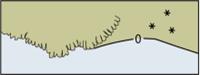
UNIT 2 How is a chart made? Charts are made by hydrographic departments across the world. Admiralty charts are nautical charts issued by the United Kingdom Hydrographic Office. The British Admiralty (BA) charts are the most commonly used ones worldwide. Over 3,000 charts are available and cover virtually the entire world in various levels of detail depending on the density of traffic and hazards. Large-scale charts often cover approaches and entrances to harbours, medium-scale charts cover heavily used coastal areas, and small-scale charts are for navigation in more open areas. Map projection and bearings The Mercator projection is almost universally used in nautical charts. There are however some exceptions for very large or small scales where projections such as the gnomonic projection may be used. Since the Mercator projection is conformal, that is, bearings in the chart are identical to the corresponding angles in nature, bearings may be measured from the chart to be used at sea or plotted on the chart from measurements taken at sea. Although allowances must be made for magnetic variation and magnetic deviation if accuracy is important. Use of this projection also has the advantage that straight lines drawn on the chart represent lines of constant bearing although in reality such lines are not straight but segments of a three dimensional “loxodromic” spiral known as a rhumb line. A bearing is the angle between the line joining the two points of interest and the line from one of the points to the north, such as a ship’s course or a compass reading to a landmark. On nautical charts, the top of the chart is always true north, rather than magnetic north, towards which a magnetic compass points. Most charts include a compass rose depicting the variation between magnetic and true north. Chart correction Marine navigation charts are in constant use by navigators. But conditions at sea and under the sea (the seabed and the features charted) keep changing and so we must have the latest information on them for safety. Is there a new wreck, and, if so, where exactly is it so we can avoid it? Has a buoy been destroyed in a storm, and, if so, do we know this so we can avoid colliding into it at night? Are their shallower depths reported in a particular location, and how do we know this? Since information is changing constantly, there has to be a foolproof, controlled and approved system of chart correction. Hydrographic organizations that produce charts are responsible for their correction. Old or uncorrected charts should never be used for navigation. The chart in use must always be corrected to the latest notices to mariners on board. All charts should be updated regularly to maintain accuracy and safety. Updates are released in Admiralty Notices to Mariners weekly. Second Officers on ships are responsible for chart correction. They receive the notices and cross reference them with which charts they have on board (or in the ‘ship’). They then correct them. This is a continuous process, and a critical one. The safety of the crew, cargo and the ship depends on a systematic and accurate means of chart correction. IV. Make-up word combinations and translate them: 1) new field 1)____________________________ 2) chart water 2)____________________________ 3) old level 3)____________________________ 4) magnetic scale 4)____________________________ 5) nautical datum 5)____________________________ 6) true wreck 6)____________________________ 7) water charts 7)____________________________ 8) shallow correction 8)____________________________ 9) chart depth 9)____________________________ 10) large deviation 10)___________________________ 11) magnetic charts 11)___________________________ 12) sea north 12)___________________________ V. Translate the following word combinations into English: 1. істинний північ – _____________________________________________________ 2. кут між лінією, яка поєднує дві точки – __________________________________ 3. забезпечувати точність та безпеку – _____________________________________ 4. підходи до портів – ___________________________________________________ 5. навігаційні небезпеки – ________________________________________________ 6. щільність руху – ______________________________________________________ 7. небезпечні підводні перешкоди – _______________________________________ 8. прокладати курс судна на карті – ________________________________________ VI. Translate the following sentences into English: 1. Другий помічник капітана є відповідальним за коректуру карт. ______________________________________________________________________ 2. Морські навігаційні карти виготовляються у різних масштабах. ______________________________________________________________________ 3. Маломасштабні карти використовуються для судноводіння у відкритому морі. ______________________________________________________________________ 4. Вгорі морської навігаційної карти завжди є істинний північ. ______________________________________________________________________ 5. Електронні карти стають все більше популярними серед судноводіїв. ______________________________________________________________________ 6. Морська навігаційна карта повинна містити у собі наступну інформацію: глибину води, інформацію щодо течій, маяків та буїв, систему розділеного руху, навігаційні небезпеки та характеристики морського дна. – _____________ ______________________________________________________________________ ______________________________________________________________________ ______________________________________________________________________ ______________________________________________________________________ 7. Карти великого масштабу використовуються штурманами для прокладання курсу судна. – _______________________________________________________ ______________________________________________________________________ VII. Self-assessment questions: 1. What is a marine navigational chart? 2. What scales may the charts be? 3. What information can we find in the chart? 4. What do you know about electronic charts? 5. How is a chart made? 6. What types of charts do you know? 7. On what chart is a ship’s planned course plotted? 8. What projection is universally used in nautical charts? 9. Where can you find the true north on the chart? 10. Should we use old or uncorrected charts? 11. Who is responsible for chart correction on ship? 12. How are the depths of the water measured and indicated on the charts? Coastline
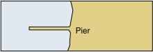
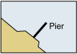
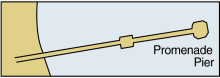
Ports
Harbour Installations
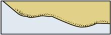
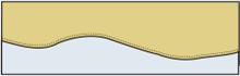
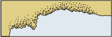
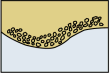
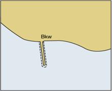
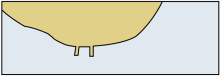
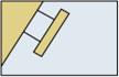
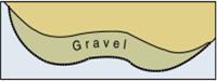
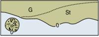
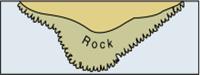
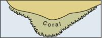
Types of Seabed
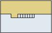
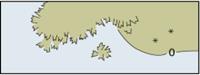
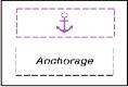
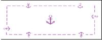
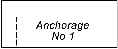
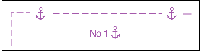
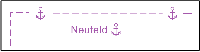
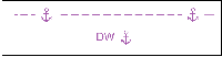
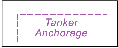
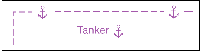
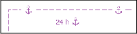
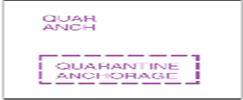
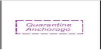
Anchorage areas
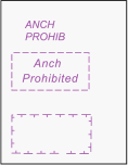
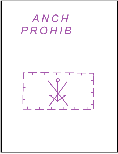
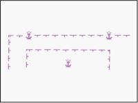
Restricted areas
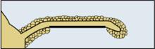
UNIT 3 Lighthouses A lighthouse is a structure exhibiting a light (a major light). This light serves as an aid to navigation. Lighthouses are always conspicuous. They are built on land and at sea. In most cases lighthouses are erected on solid foundations. Lighthouses vary in shape. They can be circular, pyramidal, quadrangular, square, cylindrical, triangular, rectangular, hexagonal and octagonal. They are built of stone, brick, concrete, iron, steel, wood, etc. Lighthouses are painted white, yellow, red, etc. Sometimes they are painted in horizontal and vertical stripes of different colours (a band is a horizontal line; a stripe is a vertical line). The lights may be fixed, flashing, occulting, alternating, group-flashing. When leading lights are exhibited, the front light is always lower than the rear light. Lightship, a distinctively marked vessel anchored or moored at a charted point, to serve as an aid to navigation. IV. Study the table: UNIT 4 UNIT 5 Lateral marks A lateral buoy (or lateral mark), as defined by the International Association of Lighthouse Authorities, is a sea mark used in maritime pilotage to indicate the edge of traffic lanes and channels. Distinct shapes, colours and numbers are used to distinguish between the port and starboard sides of channels. A channel is the route a ship must pass for safety. It is an area in the entrance to a port which has deeper water levels and is clear of any obstruction below the sea. Region A is also called red to port, because red buoys are on the port (left) side of the channel and green buoys are on the starboard (right) side when entering a harbour (reverse when departing). The ship must pass between them for safety, keeping the red buoy on her port side and the green one on the starboard side. Region B is exactly the opposite, and is remembered as red to starboard, which means that green buoys mark the port (left) side of channel and red buoys mark the starboard (right) side of channel. For easy identification, the shapes of the buoys in both regions are different, as can be seen from the diagrams. The topmarks (the small shape at the top of each buoy) are also distinctive and different. Port-hand marks carry can-shaped topmarks, and starboard-hand marks carry conical topmarks, when fitted. When the buoys are can- or conical-shaped themselves they are not fitted with any topmarks. At night, the lights on each buoy are different as well. When exhibited, red and green lights are used for Lateral marks. Lighted Lateral marks used for certain purposes have lights with specified rhythms: Composite Group Flashing (2+1) for Preferred Channel marks; Quick or Very Quick for New Danger marks. Other Lateral marks may have lights of any rhythms.
Cardinal marks A cardinal mark is a sea mark (a buoy or other floating or fixed structure) used in maritime pilotage to indicate the position of a hazards and the direction of safe water. Cardinal marks indicate the direction of safety as a cardinal (compass) direction (north, east, south or west) relative to the mark. The Mariner is safe if he passes N of a North mark, E of an East mark, S of a South mark and W of a West mark. Cardinal marks may be used to: - indicate that the deepest water in an area is on the named side of the mark; - indicate the safe side on which to pass a danger; - draw attention to a feature in a channel such as a bend, junction, branch, or end of a shoal; - draw attention to a new danger such as a grounded ship. Topmark. Cardinal buoys are fitted with two black cones. Colours. Black and yellow bands are used to colour Cardinal marks. The position of the black band, or bands, is related to the points of the black topmarks. Shape. Cardinal buoys are pillar- or spar-shaped. Light. White lights are exhibited from Cardinal marks which are lighted. Their characteristics are based on a group of quick flashes which distinguish them as Cardinal marks and indicate their quadrant.
Isolated Danger marks
Topmark. The isolated danger buoy carries two black spheres (balls), disposed vertically. Colours. Black with one or more red bands are the colours used for Isolated Danger marks. Shape. Isolated danger marks are pillar- or spar-shaped. Light. A white flashing light showing a group of two flashes is used to denote an Isolated Danger mark. Safe Water marks
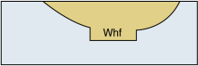
Topmark. The safe water buoy is fitted with a single red sphere. Colours. Red and white stripes are used for Safe Water marks. Shape. Spherical, pillar or spar buoys are used as Safe Water marks. Light. A white light, occulting (more light than dark), or isophase (equal light and dark), or showing a single long flash every 10 seconds. Special marks
Topmark. The special buoy carries a yellow cross. Colour. Yellow is the colour used for Special marks. Shape. They may have any shape but they must not conflict with those used for the other marks. Lights. A yellow light is used. The rhythm may be any, other than those used for Cardinal, Isolated Danger and Safe Water marks. The following are permitted examples: group occulting; flashing; group flashing with a group of 4, 5 or 6 flashes; composite group flashing. IV. Study the picture.
V. Make-up word combinations and translate them: 1) green water 1)____________________________ 2) sea rock 2)____________________________ 3) maritime buoy 3)____________________________ 4) landfall zones 4)____________________________ 5) fixed ship 5)____________________________ 6) spoil light 6)____________________________ 7) recreation vicinity 7)____________________________ 8) yellow flash 8)____________________________ 9) grounded buoy 9)____________________________ 10) cardinal cross 10)___________________________ 11) submerged mark 11)___________________________ 12) immediate pilotage 12)___________________________ 13) safe bridge 13)___________________________ 14) lateral ground 14)___________________________ 15) long buoy 15)___________________________ VI. Find the appropriate description of the different types of buoys in the table:
VII. Choose the option that does not belong to the group: 1. lifebuoy, lifejacket, lifetime, lifeboat 2. cable, rope, funnel, line 3. berth, bollard, pier, quay 4. aid, assist, obstruct, help 5. midship, bow, stern, bottom 6. order, question, instruction, command 7. speedy, quick, fast, slow 8. faultless, incorrect, mistake, error 9. move, push, pull, stop 10. channel, river, mountain, ocean VIII. Self-assessment questions: 1. What lights may be exhibited from Lateral buoys? 2. How is the starboard side of the fairway indicated in the A-system? 3. How is the port side of the fairway indicated in the A-system? 4. How is the position of the danger indicated? 5. What will give the navigator information regarding the vessel’s position in reference to the position of the danger? 6. How are the North Cardinal buoys indicated? 7. How are the South Cardinal buoys indicated? 8. How are the West Cardinal buoys indicated? 9. How are the East Cardinal buoys indicated? 10. What colour light are isolated danger marks fitted with? 11. What do safe water marks mark? 12. What lights are used on Safe Water buoys? 13. What are the yellow spherical buoys used for? 14. What are the spherical buoys painted in vertical stripes used for?
CHAPTER II OF THE ROAD IN NAVIGATION I. Vocabulary. Study the following words and word combinations: 1. dependent (depend) on [dI'pendqnt On] – залежати від 2. conduct ['kOndAkt] – поведінка, ведення, керівництво, управління 3. to determine [dI'tE:mIn] – визначати, встановлювати 4. seamanship ['si:mqnSIp] – морська справа, морська практика, майстерність судноводіння 5. application [ˏxplI'keISqn] – вживання, використання, заява, прохання 6. to define [dI'faIn] – визначати, встановлювати 7. exemption [Ig'zempSqn] – вилучення 8. annex ['xneks] – додаток 9. accepted [qk'septId] – прийнятий, визнаний 10. to apply (to) [q'plaI] – застосовувати 11. to deviate ['di:vIeIt] – відхилятися 12. roadstead ['rOudsted] – рейд 13. inland waterways ['Inlqnd 'wO:tqweIz] – внутрішні водні шляхи 14. to confirm [kqn'fE:m] – підтверджувати 15. to differ ['dIfq] – відрізнятися 16. to interfere (with) [ˏIntq'fIq] – заважати, служити перешкодою 17. to release [rI'li:s] – звільняти 18. to comply (with) [kqm'plaI] – відповідати, відповідати вимогам 19. collision [kq'lIZqn] – зіткнення 20. i.e. [ˏaI'i:] – тобто (від лат. id est) 21. the give way vessel – судно, яке уступає дорогу 22. the stand on vessel – судно, якому уступають дорогу 23. to extend [Ik'stend] – поширюватися 24. encounter [In'kaVntq] – зіткнення, зустріч 25. definition [ˏdefI'nISqn] – визначення 26. displacement [dIs'pleIsmqnt] – водотоннажність 27. craft [krRft] – судно 28. to restrict [rI'strIkt] – обмежувати 29. constrained [kqn'streInd] – обмежений 30. aground [q'graVnd] – на мілині II. Do you remember the following words? Translate them into Ukrainian:
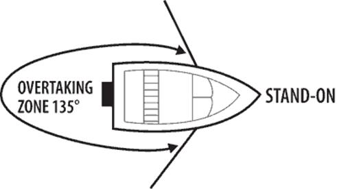
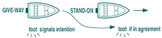
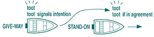
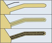
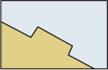
III. Show your competence on the following positions: 1. What is the COLREGS? 2. What is the purpose of using of the sea rules of the road? IV. Read and translate the following text: The safety during the voyage is very dependent on the conduct of vessel. This conduct is largely determined by Good Seamanship and depends on the proper application of the Rules of the Road. The purpose of these sea rules of the road to maintain discipline of marine traffic and ensure safety of life. The navigation rules of the road are defined by the International Maritime Organisation in what is known as COLREGS or the International Regulations For Preventing Collisions At Sea 1972. In total there are thirty eight rules which are given in five parts A, B, C, D and E which refer to the rules relating to General, Steering and Sailing (this part is divided into three sections: Conduct of vessels in any condition of visibility; Conduct of vessels in sight of one another; Conduct of vessels in restricted visibility), Lights and Shapes, Sound and Light Signals and Exemptions respectively. Apart from these five categories, there are four Annexes from Annex I to Annex IV which define the technical requirements. These internationally accepted rules apply to all vessels sailing across the ocean and in all waters navigable by seagoing vessels. Special rules that deviate from the COLREGS are allowed. However, such special rules, made up by local authorities for roadsteads, harbours, rivers, lakes and inland waterways, must confirm to the Rules and cannot differ totally from them. Responsibility Nothing in these rules shall interfere with the operation of special rules made by an appropriate authority. Nothing in these rules can release any vessel, owner, master or crew from the responsibility to comply and follow these rules. The only situation when these rules can be deviated from is when avoiding an immediate danger – the avoidance of collision being of prime importance. The rules primarily lay down the responsibilities between vessels when they meet at sea, i.e. which vessel should keep out of the way of the other (the give way vessel) and which should do nothing except maintain its course and speed (the stand on vessel). This responsibility also extends to type of vessels in the encounter when a risk of collision may exist. UNIT 7 UNIT 8 Vessel not under command Lights at night The vessel shall have 2 vertical red signal lights. When making speed through water, side and stern lights. Daytime signals The vessel shall have 2 balls in a vertical line where they can best be seen. Restricted visibility 1 long followed by 2 short sound signals at intervals of not more than 2 minutes. Pilot vessels on duty Lights at night A white signal light over a red. If the vessel is making speed through the water: sidelights and a sternlight. Daytime signals The “Pilot flag”. Restricted visibility 1 long signal followed by 4 short signals, at intervals of not more than 2 minutes. Note that a pilot vessel not on duty must act and signal as an ordinary motor-driven vessel. UNIT 9 Risk of collision Every vessel must use all available means to determine if there is a risk of collision, this also includes radar. This must be done in advance and assumptions shall not be made based on insufficient information. A risk of collision should be considered if the bearing to the other vessel is not changing. If the other vessel is close, and of a large size, the risk of collision may still be present, although the bearing is changing. Action to avoid collision All actions for avoiding a collision such as alteration of course, speed or a combination of both, shall if possible be distinct and performed in good time. If there is sufficient sea room an alteration of course may be the most effective action. The result of the action shall be monitored until the other vessel is finally clear. If more time is needed to assess the situation, reduce speed or stop. A vessel with the “right way” must also take action if no measures are taken from the other vessel and risk of collision is imminent. Narrow channels In a narrow channel, keep as close as possible to starboard. Vessels less than 20 metres and sailing vessels shall not impede the passage of larger vessels. A vessel engaged in fishing shall not impede another vessel navigating in a narrow channel. A vessel crossing a narrow channel shall not impede another vessel navigating in the channel. Navigate with caution when approaching such a bend of which the area behind it is obscured. Avoid anchoring in a narrow channel. UNIT 10 Overtaking If a vessel is approaching another vessel from behind, within the theoretical sector of the forward vessel’s stern light, it is considered as an overtaking vessel, and it must give way in all circumstances until the other vessel is finally passed and clear. It can overtake on either side. The overtaking zone:
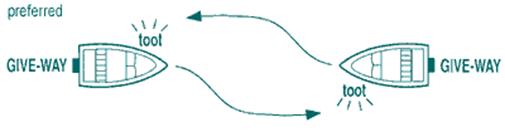
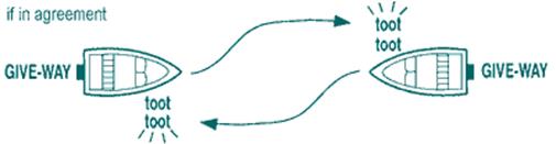
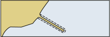
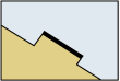
Leave to port: Leave to starboard: Sound and light signals are prudent to indicate to the vessel which side the intention is to overtake on. The vessel being overtaken will signal agreement with specified sound/ light signals, foghorn and/ or light. Head-on situation In case of a head-on situation between two power-driven vessels, both shall alter course to starboard (right) and pass on the port (left) side of the other. A head-on situation exists by night if both red and green sidelights are visible. And if there is doubt about the situation, it shall be assumed that it is a head-on. Port to Port (preferred)
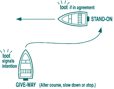
Leave to Starboard (if in agreement) Crossing situation In case of a crossing situation between two power-driven vessels, the one that has the other on its starboard side shall give way and avoid crossing ahead of her. The “stand-on” vessel must maintain its course and speed. The “give-way” vessel can alter speed or alter course, or indeed, a combination of the above.
If both vessels are head on (on reciprocal courses) each will alter course to starboard and keep out of the way of the other. Action by “give-way” vessel When a vessel has the obligation to give way, it shall do it in good time and as distinctly as possible. Action by “stand-on” vessel The vessel with right of way – or stand-on vessel – shall maintain its course and speed. However, when it is clear that the “give-way” vessel is either not taking any actions or not doing enough for preventing a collision, then the “stand-on” vessel must act. In such a situation, the “stand-on” vessel shall not alter its course to port. CHAPTER III AND WATCH ARRANGEMENTS I. Vocabulary. Study the following words and word combinations: 1. verification [ˏverIfI'keIS(q)n] – перевірка 2. substantially [sqb'stxnS(q)lI] – істотно 3. primarily ['praIm(q)rqlI] – спочатку, попередній 4. issue ['ISu:] – положення, пункти 5. loose gear [lu:s gIq] – незакріплені механізми 6. to be aimed [eImd] (at) – бути націленим на 7. multipath ['mAltIpQ:T] – багаточисельний 8. composition [ˏkOmpq'zIS(q)n] – склад 9. concern [kqn'sE:n] – турбота, стурбованість, увага, відношення 10. to decipher [dI'saIfq] – розшифрувати 11. invaluable [In'vxljub(q)l] – неоцінимий 12. judgement ['GAGmqnt] – думка, рішення 13. pertinent ['pE:tInqnt] – відповідний, доречний 14. amended [q'mendId] – виправлений (з поправками) 15. relevant ['relIv(q)nt] – відповідний 16. to comply with [kqm'plaI wID] – відповідати, відповідати вимогам 17. unattended [ˏAnq'tendId] – без нагляду 18. to hinder ['hIndq] – заважати, перешкоджати 19. seamanship ['si:mqnSIp] – морська справа, морська практика, майстерність судноводіння 20. to affect ['xfekt] – впливати 21. core subject – основне питання 22. leadership qualities – командні якості 23. unmanned machinery spaces (UMS) – машинне відділення з безвахтовим обслуговуванням II. Show your competence on the following points: 1. What International Conventions were adopted for providing safety at sea? By whom? When? 2. What Rules are to be observed while keeping watch? 3. What are the main positions of STCW aimed at? 4. How is STCW deciphered? 5. What provides safe navigation? III. Read and translate the following text: Prior to each voyage the Master of every ship shall ensure that the intended route from the port of departure to the first port of call is planned using adequate and appropriate charts and other nautical publications necessary for the intended voyage containing accurate, complete, and up-to-date information which are of permanent or predictable nature, and which are relevant to the safe navigation of the ship. Watch arrangements When deciding the composition of a navigational watch, which may include appropriate qualified ratings, the following factors shall be taken into account: 1. At no time shall bridge be left unattended. 2. Weather conditions, visibility and whether there is daylight or darkness. 3. Proximity of navigational hazards which may make it necessary for an officer in charge of a navigational watch to carry out additional navigational duties. 4. Use and operational conditions of navigational aids such as radar or electronic position-indicating devices and other equipment affecting the safe navigation of the ship. 5. Whether the ship is fitted with automatic steering. 6. Whether there are radio duties to be performed. 7. Unmanned machinery spaces (UMS) controls, alarms and indicators provided on the bridge, procedures for their use and limitations. 8. Any unusual demands on a navigational watch that may arise as a result of special operational circumstances. The success of any passage demands on such key factors: the state of the vessel and her equipment, the competence, experience, knowledge and leadership qualities of the master, and the crew. Those intending to put to sea in charge of a vessel have a duty to all on board, and as part of the safe passage plan, to gather as much information about the predicted weather is possible, and apply their own judgement on the conditions to be expected. Local knowledge can be invaluable. Good seamanship starts in port. Check and double-check that cargo-securing arrangements are in place before putting to sea, and that any loose gear has been properly secured. UNIT 12 UNIT 13 WATCHKEEPING I. Vocabulary. Study the following words and word combinations: 1. wheel [wi:l] =helm – штурвал 2. log book – вахтовий журнал 3. watertight integrity – водонепроникність 4. to rig pilot ladder – озброїти лоцманський трап 5. deployment [dI'plOImqnt] – використання 6. to plot – прокладати курс 7. alteration [ˏO:ltq'reIS(q)n] – зміна, змінення 8. accuracy ['xkjqrqsI] – точність 9. to summon ['sAmqn] – викликати 10. to impair [Im'pFq] – погіршувати, псувати, завдавати збитку 11. to be obliged [q'blaIGd] to – бути зобов’язаним 12. uninterrupted [ˏAnIntq'rAptId] – безперервний 13. to acquaint [q'kweInt] – знайомити, ознайомити, інформувати 14. appraisal [q'preIz(q)l] – оцінка 15. tedious ['ti:dIqs] – нудний, утомливий, тривалий 16. tiring – виснажливий 17. acknowledgement [qk'nOlIGmqnt] – підтвердження 18. countermand [ˏkauntq'mRnd] – відміняти розпорядження, наказ 19. to execute ['eksIkju:t] – виконувати 20. rudder indicator – аксіометр 21. pay off – відклонятися від курсу 22. answer the helm = respond to helm – слухатися руля II. Read and translate the following text: General duties Various duties are carried out by watchkeepers was either individually or as a bridge team. Experience has shown that the bridge becomes the operational centre for the watch period, with all relevant information and orders processed through it. The deck log book is maintained on the bridge by the office of the watch (OOW), together with continual observation and supervision of the following items: (a) Watertight integrity of the hull, together with the opening and closing of watertight doors. (b) Fire watch, with continual observation of smoke detector systems. (c) Special cargo surveillance, as and when required. (d) Correct display of all lights and shapes. (e) Weather conditions affecting the ship and its course. (f) Routine working of the deck, inclusive of rigging pilot ladders, deployment of logs, organising boat and fire drills etc. (g) All emergencies affecting of the safety of the vessel. Calling the Master The officer of the watch should notify the Master immediately in the following circumstances: (a) If restricted visibility is encountered or suspected. (b) If the traffic conditions or the movements of other vessels are causing concern. (c) If difficulty is experienced in maintaining course. (d) On failure to sight land or navigation mark, or to obtain soundings by the expected time. (e) If land or navigation mark is sighted or a change of soundings occurs unexpectedly. (f) On the breakdown of the engines, steering gear or any essential navigational equipment. (g) In heavy weather, or if in any doubt about the possibility of weather damage. (h) In any other emergency
|
||||||||||||||||||||||||||||||||||||||||||||||||||||||||||||||||||||||||||||||||||||||||||||||||||||||||||||||||||||||||||||||||
|
|
Последнее изменение этой страницы: 2016-04-21; просмотров: 515; Нарушение авторского права страницы; Мы поможем в написании вашей работы! infopedia.su Все материалы представленные на сайте исключительно с целью ознакомления читателями и не преследуют коммерческих целей или нарушение авторских прав. Обратная связь - 216.73.217.89 (0.009 с.) |


 An Isolated Danger mark, as defined by the International Association of Lighthouse Authorities, is a sea mark used in maritime pilotage to indicate a hazard to shipping such as a partially submerged rock in the immediate vicinity of the buoy. Ships should keep clear of it.
 A Safe Water mark is a sea mark used in maritime pilotage to indicate the end of a channel. It is used to indicate that there is navigable water (safe water of sufficient depth) all round a mark. Such a mark may be used as a centerline, mid-channel or landfall buoy, or to indicate the best point of passage under a fixed bridges. A ship can pass any side of it.
 A special mark is a sea mark used in maritime pilotage to indicate to the Mariner a special area or feature, the nature of which is apparent from reference to a chart. Special marks can indicate: anchorage areas, mooring areas, pipelines, spoil ground (an area where dredged material is deposited); cables; recreation zones.